Capacity building
GEO/GEOSS/INSPIRE | |  | | 
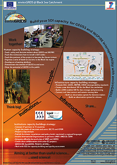
EnviroGRIDS has developped its own capacity building strategy to stengthen people, institutions and infrastructures for GEO and INSPIRE activities in the Black Sea region.
InstitutionInstitutions capacity buildings strategy:
PeopleHuman capacity building strategy:
InfrastructureInfrastructure capacity building strategy:
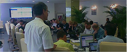
enviroGRIDS WORKSHOPSSeveral workshops are being organized around the Black Sea to Bring GEOSS and INSPIRE into practice, and to present them to important decision and policy makers makers.
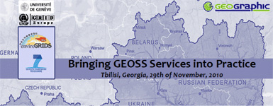
Bringing GEOSS Services into practice
Next workshop: 23 September 2011, Istanbul, Turkey
The Black Sea regional training workshop series "Bringing GEOSS Services into Practice", sponsored by the European Commission’s 7th Framework Programme (FP7) project enviroGRIDS, aims at teaching how to install, configure and deploy a set of open source software to publish and share spatial data and metadata through the Global Earth Observation System of Systems (GEOSS) using OGC web services & ISO standards. GEOSS has been created as an international voluntary effort that connects y geospatial and Earth Observation and information infrastructures, acting as a gateway between producers of environmental data and end users. The aim of GEOSS is to enhance the relevance of Earth observations and to offer public access to comprehensive, near‐ real time data, information and analyses of the environment. The training workshop covers interoperability, hands‐ on experience with web portals, information access, open source software and spatial data sharing through web services and the GEOSS registries. Consult the project agenda to see when the next workshops are planned in the Black Sea region.
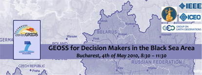
GEOSS for Decision Makers in the Black Sea Area
The Black Sea Catchment is internationally known as one of ecologically unsustainable development and inadequate resource management, which has led to severe environmental, social and economic problems. The enviroGRIDS project addresses these issues by taking advantage of emerging information technologies that are revolutionizing the way we are able to observe our planet. The Global Earth Observation System of Systems (GEOSS), being created by the Group on Earth Observations (GEO), provides a framework and the information for environmental management and decision making perspective. enviroGRIDS aims to enhance GEOSS by building the capacity of scientists to assemble such a capability in the Black Sea Catchment, the capacity of decision-makers to use it, and the capacity of the general public to understand the important environmental, social and economic issues at stake. This workshop provides a high level overview of GEOSS and data interoperability as they relate to the needs of senior government officials and decision makers in the Black Sea area. Consult the project agenda to see when the next workshops are planned in the Black Sea region. INSPIREConcerning INSPIRE, we have written a white paper describing the INSPIRE Directive and giving a quick overview on tools available allowing exposing INSPIRE-compliant services (discovery, view, download, and transformation). It is available below:
|

GEOSS workshops | |
Next workshop: 23 September 2011, Istanbul, Turkey "Bringing GEOSS services into practice" aims at teaching participants how to install, configure and deploy a set of open source software to publish and share data and metadata through the Global Earth Observation System of Systems (GEOSS) using OGC web services & ISO standards. GEOSS has been created as an international voluntary effort that connects geospatial and Earth Observation and information infrastructures, acting as a gateway between producers of environmental data and end users. The aim of GEOSS is to enhance the relevance of Earth observations and to offer public access to comprehensive, near-real time data, information and analyses of the environment. This meeting is held within the framework of the enviroGRIDS project that addresses the environmental problems surrounding the Black Sea Catchment. This area is known as one of ecologically unsustainable development, where inadequate resource management has led to severe environmental, social and economic problems. enviroGRIDS aims at improving this by building capacities for sharing and exchanging environmental data through GEOSS. Below are found the CD-ROM ISO image distributed during the workshop, as well as all individual files contained in the CD.
EnviroGRIDS portal tools | |
A workshop on the tools currently being developed for the future EnviroGRIDS portal was held at UNESCO-IHE in Delft, The Netherlands, on April 18th, 2011. The workshop was lead by the Technical University of Cluj-Napoca (UTC). (Dorian Gorgan, Victor Bacu, Denisa Rodila). CRS4 partner (Pierluigi Cau and Simone Manca) also participated in the workshop programme.
Virtual Training Center | |
The Virtual Training Center of the enviroGRIDS research project is set-up for providing various learning resources to the project partners, stakeholders from the Black Sea Catchment involved in environmental management at different levels and anyone who is interested in the research topics covered by enviroGRIDS. Learning material in the virtual training center is provided from existing resources available within the enviroGRIDS consortium partners, resources generated through the research activities of the project and various contributions from workshops, symposia and conferences organized with collaboration or participation of enviroGRIDS partners in which contributions are provided from external partners, but on topics closely related to enviroGRIDS.
|

