UMA
 |
|  |
| 
![]()
University of Malaga / European Topic Centre – Spatial Information and Analysis
The UMA ETC/SIA is an international consortium contracted to support the European Environment Agency (EEA) in developing seamless European wide spatial reference data. ETC/SIA's main working area is the analysis of land use and land cover. This includes monitoring temporal changes of land use and land cover in addition to analyzing the environmental consequences. The consortium is leaded by the Universidad de Málaga since January 2011.
UMA ETC/SIA experience is based on a good partnership of high level experts dealing with database management, quality assurance and environmental assessments. Among other activities, the ETC/SIA provide expertise in regional assessments for rural, mountainous, urban or coastal areas and in impact analysis of structural and cohesion funds, CAP expenditures or interdependencies between biofuel production and Land use changes.
Substantial parts of UMA ETC/SIA activities are dedicated to collect, manage, analyze and display land use related spatial data. The ETC/SIA is involved in developing open source solutions to follow the Inspire directive and the European policy on SEIS fitting into a network of distributed resources and simplifying the data access for the public.
The ETC is embedded and part of the European Environmental Information and Observation Network (Eionet) and is cooperating with other European institutions like the Joint Research Centre (JRC), Eurostat (Eurostat), the different DGs of the European Commission and ESPON (European Spatial Planning Observation network).
Representatives of universities, national authorities, governmental institutions and private companies cooperate closely to provide most updated spatial information and analytical results to the European public network. Furthermore, UMA ETC/SIA are linked to regional conventions as well as international NGOs who support us in testing and implementing generated data in their specific data systems. Our partners belong to the international scientific community involved in national and international research projects.
Main international research activities
- Coordination of the European Corine Land Cover 2000 and 2006
- Development of a harmonized European methodology for the identification of risk areas for soil contamination.
- Development of the spatial dimension agro-environmental indicators for IRENA
- Leading the DG Environment Working Group on Indicator and Data to develop a set of indicators to monitor progress in Integrated Coastal Zone Management (ICZM) since 2002
- Spatial modelling and analysis in support of integrated environmental assessments and development of indicators for assessing the European State of the coast
- Support in developing the Shared European Integrated Spatial Information Service through integration of new basic reference data into TERRIS (e.g. data set on urban morphological zones to analyze spatial changes in and around urban areas and their interaction with the surrounding land – access to recreational areas).
- Developing the method on “Land and Ecosystem Accounting” (LEAC) together with the EEA – a method to measure land cover changes based on different inventories of the CLC (or other) database.
- Through LEAC methodology, a number of indicators have been calculated (e.g. fragmentation of land and ecosystems, land take by urban sprawl and transport networks, pressures on protected areas, etc.).
- ESPON ESaTDOR: European Seas and Territorial Development Opportunities and Risks (2010-2013)
- EC FP7 Envirogrids (2009-2011)
- EC FP7 MS.MONINA: Multi-scale Service for Monitoring NATURA 2000 Habitats of European Community Interest (2010-2013)
The project will essentially be implemented by:
- Mr. Andreas Littkopf
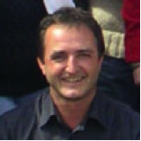 I studied agronomy at the Humboldt University Berlin Germany (1986), and in 2000 business administration for public bodies. Since 1990 I have been dealing with the implementation of European environmental directives on local, national and international level. In 2007 I became the manager of the consortium and therefore I am responsible for a smooth realization of projects in agreement with the EEA and a working climate free from distortion. I am also involved in several GMES activities and the initiation of further projects. So- I am in charge for the sustainability of the ETC, the good mood, regularly salary payments and when nobody likes to decide., Environmental researcher, ETC/SIA Manager
 - Ms Ana Barbosa
 Ana Barbosa is graduated in Geography and Planning, in 2005 from University of Minho, Portugal. Then she started working as junior geographer at the Municipality of Póvoa de Lanhoso, Portugal (2006-2007). She was granted a fellowship to join the former UAB/ETC-LUSI in December 2007 to complete the research part of a MSc in Geographic Information System from ISEGI, New University of Lisbon, Portugal. During the stay at the ETC, she has been working on modeling of land use and she has also contributed to GIS tasks on the Hydro Systems and Reference Data projects. In January 2011, she moved to Málaga to take part of the new ETC/SIA. She deals with modelling, land use scenarios at EU as well as, data integration and EEA data users requirements activities. For EnviroGRIDS she is responsible for the modelling land use activities, land use scenarios, also, she is collaborating to develop the Black Sea Catchment Observation System for decision-makers., GIS specialist and Environmental researcher
 - Mr. Emanuele Mancosu
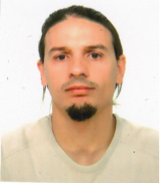 He holds a University degree in Natural Sciences from the University of Cagliari with a graduation thesis in thematic cartography (2004) and a Master degree in “Technology of System Information” from LIGIT - Autonomous University of Barcelona (2007-2009).
He starts his work in ETCLUSI at the beginning of 2009, giving support GIS tasks, system administration and data management activities. He is involved in EEA activities as in WA3 on upgrade ECRINS as reference layer and in the European project enviroGRIDS. Since January 2011 takes part of ETCSIA team in Malaga. For enviroGRIDS he is collaborating for the WP3.3 on Land Use scenarios and also WP 3.4 on Scenarios integration., Data manager and GIS specialist - Mr. Alejandro Simon
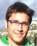 Alejandro holds a B.Sc. degree in Environmental Sciences from the University of Salamanca (Spain) and a post-graduate diploma in Geo-Informatics from ITC (The Netherlands). He worked for the University of Lleida (Department of Geography and Sociology) from 2006 up to 2008 in projects like “Environmental atlas of Lleida, Spain” or “The Development of European Waterways, Road and Rail Infrastructures: A GIS for the History of European Integration (1825-2005) ESF Project”. At the same time, he began his PhD under the title of “Research of the relationship between the urbanization process in Europe from 1850 to 2005 and the Climate Change observed”. His main tasks were related to GIS and RS fields. He joined the former ETC-LUSI in October 2008 and moved to Málaga in January. He primarily works on the Urban projects (ESPON and EEA) and Geoland2 (Kopernikus - GMES Land Monitoring Core Service). Since January 2011 takes part of ETCSIA team in Malaga., GIS specialist and Environmental researcher

